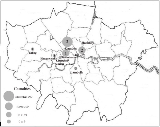
Figure 4 shows some of Greater London’s central neighborhoods. As with previous figures the map designates the location of attacks, the casualties inflicted (designated by the size of the circle)…
You need a TRAC license to view the rest of this content. Learn more